

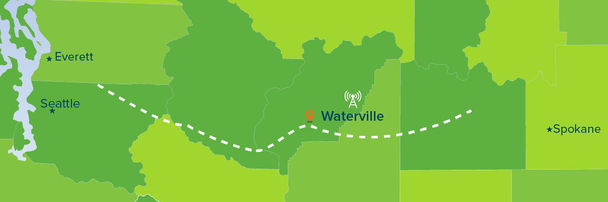
Waterville — Coming out of the Wenatchee Valley, you wind up rock hills along the Columbia River and suddenly emerge on top of the Waterville Plateau where coulees, cliffs and canyons give way mostly to wide open spaces and undulating wheat fields as far as the eye can see.
It’s a dramatic shift along Highway 2. Up until this point, the road has led you through forests, mountains, orchards, and across the Columbia River. Now, it’s all one vast, mammoth space. In Seattle, we lament the loss of open space, but here there’s a glut of it. A “neighbor” might live two or three miles away.
The plateau is a dry, hot place in summer. The first town you come to is Waterville, so named because finding a well here was such a big deal the name attracted parched settlers. There’s little shade on the plateau, and though they had a wet year—farmers told us the wettest since the late 1940s — it gets only about 11 inches of rain a year. Seattle gets nearly 40.
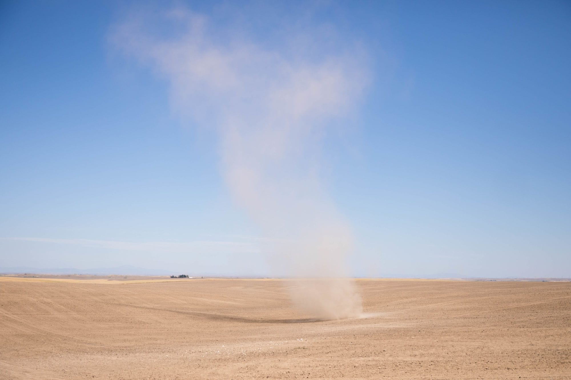
Along the road photographer Matt Mills McKnight and I see distant dust devils — those short-lived mini-twisters that appear and disappear like a prairie hallucination. Dust-raising farm equipment in the fields creates clouds that can hang like a haze of topsoil. Remote farms dot the distance. Small roads off the highway seem to lead into eternity.
Here and there rough geology intrudes. Ungraspable titanic geologic forces shaped the landscape and evidence of this interrupts the tidy fields where farmers have had to work around giant boulders or piles of lava rock too thick to move. These sit like islands surrounded by wheat, reminders of untamable, immoveable forces.

This dry, amazing landscape was once shaped by catastrophic floods that scoured it during the last ice age. Glacier melt filled a lake behind an ice dam in Montana, and when the would dam burst, which happened more than once, enormous quantities of water — the so-called Missoula floods — cascaded over the region. Boulders and soil from the floods can be found as far away as the mouth of the Columbia and the Willamette Valley in Oregon. They left their mark here, too.
We wanted to see one of the most spectacular geologic relics of this flooding. Just off Highway 2 near Coulee City, we stop at Sun Lakes-Dry Falls State Park. There’s an observation point where you can look into a massive hole some 400 feet deep and three-and-a-half miles long. In the bottom are small lakes and wetlands. Once, the ancient floodwaters turned these cliffs into a massive series of waterfalls three times the size of Niagara Falls. Think of the hydropower that could have been generated!
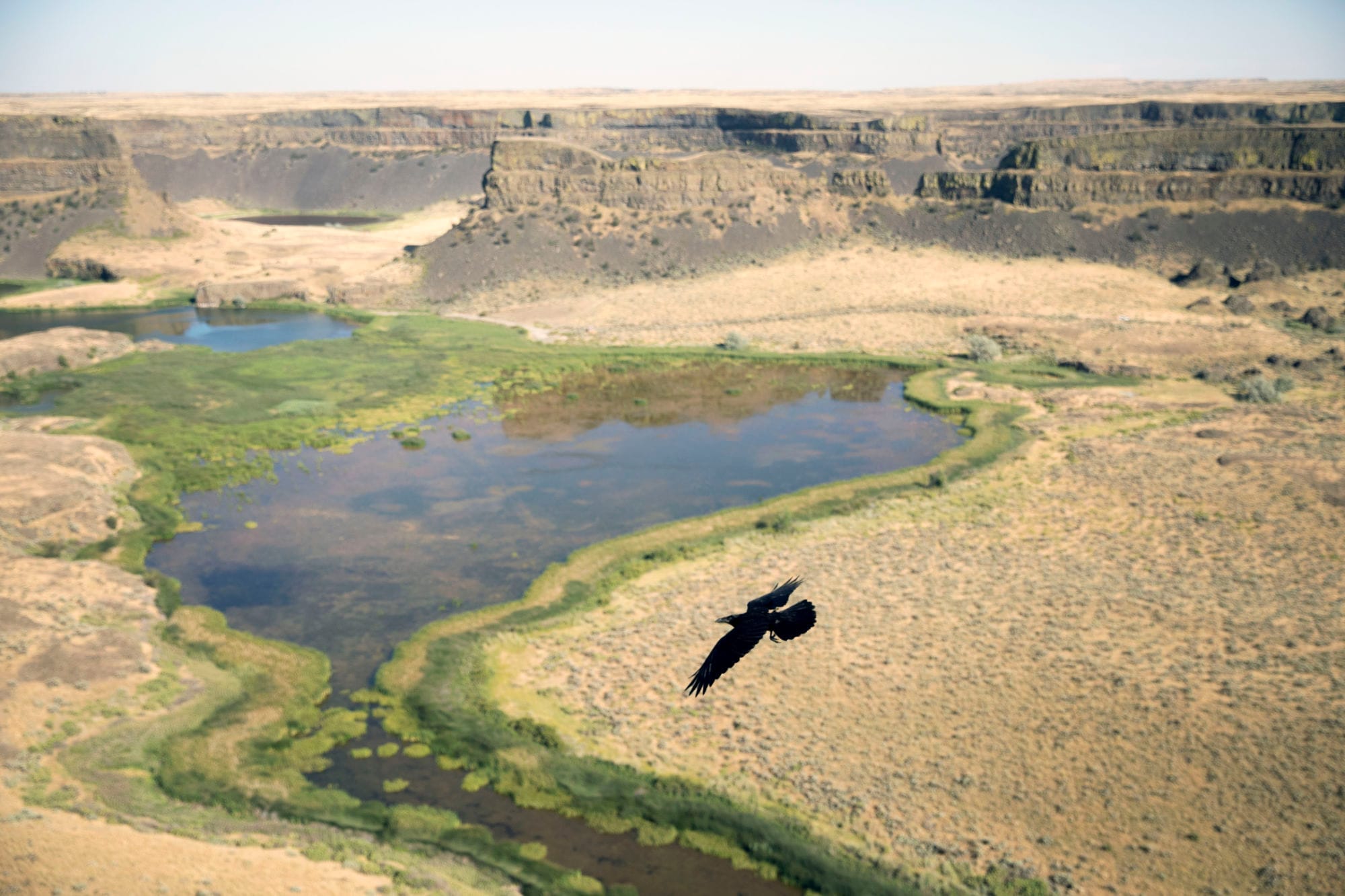
It’s late in the day when we arrive, but the low sun lines the yellow rock with shadows that highlight the rugged formations surrounding the wetlands below, which look like a kind of oasis. One of the lakes at the bottom is called Deep Lake, carved out where the falling waters blasted the soil. We wend our way down a series of roads to reach it. As the sun sinks we see a flock of wild turkeys and a couple of mule deer with their huge upright ears lit by the sun. At the lake, flycatchers are having a field day hunting bugs at the water’s edge.
Water also gives life here. Dry Falls marks the southern end of Grand Coulee, and the dam is just to the north. It’s waters back up to Coulee City in the form of the reservoir, Banks Lake. As you enter Coulee City, Highway 2 runs along an irrigation dam that’s part of a regional system providing water and power to farms and ranches. This would be desert otherwise. The government runs a massive reclamation project here to turn Eastern Washington’s sagebrush into crops.

Transmission towers on the Waterville Plateau, which provide power to many of the Wests’ major cities.
The biggest structures are massive power transmission towers, also the result of federal government investment in the region, carrying that energy where it’s needed throughout the West, from Seattle to Southern California. Just as the Missoula floods shaped this country, the Columbia continues to do so still with the force of melting ice, snow and glaciers.
Another new aspect connecting land and electric power: This summer, Highway 2 became the “first electric-vehicle-friendly scenic byway in all of America,” according to the Spokane Spokesman-Review. Electric car charging stations have been placed a strategic intervals like gas stations and drive-in espresso stands along the road from Everett to Spokane. The effort, pushed by Plug-in North Central Washington, is designed to attract “the automotive version of ecotourism to the region.” This is a place where you can now road-trip with assurance in your Leaf or Bolt. We saw charging stations, but never a car charging up. Note to Tesla owners: Hit the road.
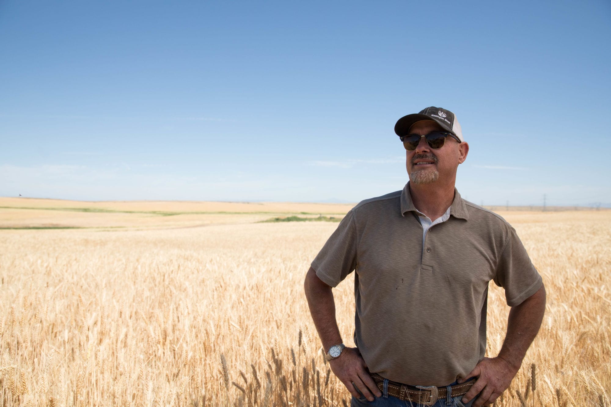
The spatial shift in these parts is also dramatic. Being one small person in a vast space can be humbling and also mind-clearing. I ask Howard McDonald, a wheat farmer near Coulee City, if he feels anything like that. “There are times when I’ll just come out and set here, to clear the mechanism,” he answers, an apt reference to clearing his mind for a man who fixes his own equipment.
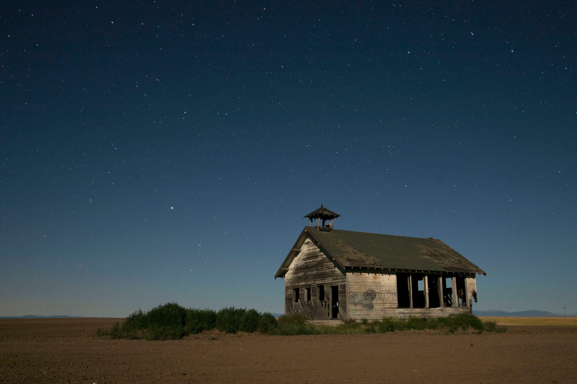
Mechanism-clearing can occur at night too. I remember years ago attending a local festival in Wilbur, down the road from Coulee City in Lincoln County. We celebrated at the legendary Deb’s Café in nearby Creston. It is now closed, but was then run by a legendary rodeo cowboy named Deb Copenhaver. Coming out one night I was bowled over by the sky.
Light pollution in Pugetopolis has all but obliterated the heavens. Here, though, the clear summer skies, darkness and vast spaces open them up — the gushing starlight of the Milky Way, the pure abundance of stars, streaking meteors.
Adding to the sky drama, we heard that there was a possibility of seeing the Northern Lights due to solar activity. My colleague Matt was determined to photograph the phenomenon so we set forth one night after dark to find them. Near 1 a.m., after following a road along Banks Lake up to Steamboat Rock near Electric City by Grand Coulee Dam, we spotted a glowing, shifting green curtain hanging in the horizon. Such sightings are rare at this latitude, and almost impossible to see with the naked eye where city lights wash out the sky.
It’s no wonder that people in places like this feel closer to divine influences, and the need to be self-sufficient in light of our relative smallness. For all the virtues of big cities, losing connection with the cosmos is a huge price to pay. Here in plateau country, you can plug in your electric car, but it also feels easier to plug into something bigger than yourself.

Headlights are seen on the horizon of Highway 2 at Armour Draw, near Moses Coulee in Douglas County, Washington.
Next: Near Davenport, We Went Looking for an Outlaw and Found a Wildfire.
